By Diane Luhrs, President, HFNC
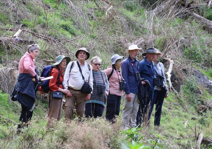
Generally, the camp went very well with participants enjoying the excursions, special presentations by key-note speakers and HIRL (Hamilton Institute of Rural Learning) as the base for the weekend. Of the 135 people who registered for the weekend, 130 were able to attend. The overriding sentiment was that it was good to be back in action after the Covid-19 restrictions of 2020 put SEANA gatherings on hold for over a year. This campout allowed for people to catch up and renew friendships as well as to explore areas new to them.
Some of the comments received:
Best wishes to you and your friends at the Hamilton Field Naturalists. I really hope your weekend was wonderful and lived up to the 2 years of effort and thoughts and hard work that underpinned the event. … The people we met on the night were lovely and the guests were such a great bunch. All of our helpers very much enjoyed the night. It was very good to work together with a dedicated and passionate group who are part of our ‘tribe’ too.
Just wanted to say an extra big thank you for the wonderful weekend we spent with your club and in your beautiful town. We have learnt so much about Hamilton and the surrounding area.
The organisation of the whole weekend from our point of view was meticulous with the HIRL being a fantastic administration area for our SEANA camp.
We thoroughly enjoyed both of our excursions with special thanks to Ross, Fiona and Roger for their knowledge and leadership.
Please accept our thanks and gratitude to you and your club for the work and effort over an extended period put in to produce such successful and enjoyable event.
… [C]ongratulations on a wonderful camp. The overall organisation was excellent and the variety and organisation of the excursions also excellent. I really enjoyed [the] day on the Wannon as well as ‘ticking off’ Mt Rouse on the Sunday (last of the major Victorian volcanoes for me to visit). We had the good fortune to coincide with an open day at the Volcano Discovery Centre at Penshurst and had a terrific talk from Paul (didn’t catch his surname). Even with my geological background there were all sorts of up to-the-minute snippets that were new to me. … On a more general note, it was wonderful to catch up with everybody after such a long break.
Thank you for a wonderful weekend meeting. We had a lovely time and we are now filled with the ambition to come back in the Spring. We are most grateful to you and all your magnificent team.
Many thanks for a great camp and the chance to greet many people. Congratulations for a camp well organised, the food was delicious and the meeting venues easy to find.
Thank you so much for a lovely SEANA camp last weekend. It was so great to explore the area with other Naturalists. We thought your organisation of the whole weekend was amazing and the catering was fantastic and the speakers were excellent. We enjoyed using the nature guide and will be back to explore some more.
Our thanks to the Hamilton FNC for putting on an interesting, most enjoyable and successful camp. We appreciate the effort that went into organising and holding the event. The focus on the NGT work was of particular interest and we were very impressed. Mark and Greg are very good at sharing their knowledge and explaining the work that they do. The volcanic features tour was really interesting. Please pass on our thanks to Janeen for the wonderful job she did of explaining 1it all and guiding us. The bandicoots were a special highlight. Congratulations on the work your club does to conserve them.
Great team effort from HFNC. The Budj Bim tour was excellent and up to expectations. Braydon was a great choice to lead the day. We thoroughly enjoyed the volcanics tour with Yvonne and Reto especially in learning a great deal and having many good photo opportunities. The guest presenter Mark Backmann gave an inspiring talk – he is someone who knows how to get things done on the ground. HIRL was a great venue – it is amazing to see how it has developed over time.
The entire event was a pleasure to attend. Everything was well organised and ran very smoothly, especially considering there were over 100 field naturalists present. The tour of Walker, Green, Gooseneck and Bradys Swamps on Saturday was excellent. Great to see the positive work done by NGT. The tour of Byaduk cave and Mt Eccles on Sunday was also a pleasure. Nothing was rushed. I learned a great deal about the geology and ecology of the area. A massive thank you to all involved.
Loved Sunday’s geology, especially the Tumuli and Mt Eccles caves. HIRL was a great venue and the catering by DRASS on Friday night was excellent. Overall, the organization was brilliant.
Our program included a Welcome to Country by Gunditjmara Elder Uncle Johnny Lovett, two key note presentations and dinners on Friday and Saturday nights with a wind-down meal at the Caledonian Hotel on Sunday night. On Friday night at HIRL, Yvonne Ingeme and Reto Zollinger both made presentations outlining the life-cycles of the Eastern Barred Bandicoots and of the work at HIRL to provide suitable protected habitat and support for these once common mammals of the region. Reto and Yvonne then led excursions into the bandicoot enclosures to show the visitors these precious mammals, and most were pleased to have seen at least one bandicoot.
On Saturday night the highlight of the evening was Mark Bachmann’s presentation on wetland restoration and of his philosophy underpinning this work. All participants were impressed with Mark’s successes over the years and remarked on how well he demonstrated a path to ecological success through quiet persistence, tenacity in ideals, ability to source funding and of his knowledge of ecology itself and of how to encourage people to work with rather than against ecological restoration. Another special occurrence at this event was the launch by Phil Rayment – President of SEANA – of HFNC’s Hamilton Region Nature Guide – Second Edition.
Our excursions program included escorted tours to nine different locations in the region as well as three self-guided tours on Saturday and Sunday. Waterways, waterfalls, lakes and restored wetlands, grasslands, volcanic landforms, woodlands and the Budj Bim World heritage area were represented in these tours.
Time | Activity | Place |
| Friday 16 April 2021 | ||
| 3 pm on | Registration & tea/coffee – afternoon tea; Fill in excursion preference sheets | HIRL – Hamilton Institute of Rural Learning Nth Boundary Rd, Hamilton |
| 5.45 pm | Welcome to SEANA Autumn 2021 | |
| 6.00 pm | Welcome to Country – Uncle John Lovett | |
| 6.15 pm | BBQ Dinner provided by Maree Wiley and DRASS (BYO drinks) | |
| 8.00 pm | Guest Speakers – Yvonne Ingeme & Reto Zollinger – Eastern Barred Bandicoot – Status and Recovery | |
| 9.00 pm | Bandicoot Walk – with red-light torches (BYO own torch – HFNC will provide the red cellophane and rubber bands) | Bandicoot Enclosure – Community Parklands |
Saturday 17th April 2021
| ||
| 5.00 pm | SEANA AGM | HIRL |
| 6.15 pm | Dinner with Gildo’s Catering Company (buy drinks at the venue) | Grange Burn Motel on Ballarat Rd |
| 8.00 pm | Launch of the Hamilton Region Nature Guide (Second Edition) – SEANA President, Phil Rayment | |
| 8.15 pm | Guest Speaker – Mark Bachmann (Nature Glenelg Trust) “Wetland Ecology and Restoration” | |
| 9.30 pm | Formal “Thanks” | |
| Sunday 18th April 2021 Meet at HIRL for the start of the day’s excursions |
||
| 5.00 pm | SEANA program end ➔ an evening meal together at the Caly Hotel | |
A brief outline of each tour – some with sightings – and some photographs follow below . Thank you to the people who put together the sightings lists and summaries and supplied photographs of the excursions.
Leaders: Reto Zollinger and Yvonne Ingeme (Saturday) and Roger Thompson and Ross Simpson (Sunday)
Gunditjmara people – stone-house remains, eel traps and restored wetland.
Lake Condah/Tae Rak (is part of the 9,935 ha Budj Bim Cultural Landscape that was inscribed on the UNESCO World Heritage List on 6 July 2019. It was stated to be one of the world’s most extensive and oldest aquaculture systems where the water flow was manipulated to trap, store and harvest Kooyang (Short-finned Eel). Lake Condah/ Tae Rak and the adjacent lava flows of Allambie, Muldoons, Kurtonitj, Peters, the former Condah Mission and part of the Darlot Creek – Fitzroy River (Tyrendarra Indigenous Protected Area), are vested in the Gunditj Mirring
organisation.
The swamp formed first after Budj Bim erupted about 55,000 years ago and the Tyrendarra lava flow blocked and diverted streams, eventually creating the 4,800 ha Condah Swamp and Lake Condah/Tae Rak. This ‘new’ lava flowed over the older basalts, which overlaid sedimentary deposits, including limestone. Dating of the sediments in Lake Condah/Tae Rak indicate an age of 8,000 years. The eel culture dates to at least 6,600 years.
Most reported that this was a most enjoyable excursion and Braydon Saunders was reported as an excellent guide over the Allambie and Lake Condah sections. I was disappointed, however, to learn that participants did not get to see the Muldoon’s section containing the eel-traps as had been originally negotiated for this trip. Some participants did travel independently to Tyrendarra to look at the eel traps there and others used the spare time to explore the areas near by before returning to Hamilton.
Byaduk Caves to Budj Bim – Volcanic features of this extensive area: Harmans Valley views, Byaduk lava caves, Wallacedale Tumuli and Budj Bim (Mt Eccles) with its crater lake and lava tunnel.
Leaders: Janeen Samuel and Ruth and Ivor Graney
Byaduk Caves: The long lava flow from the volcanic eruption that ran down the Harman Valley was fed by lava tubes which continued to carry liquid lava after the surface cooled to a solid crust. A 1.5 km loop walking trail, with interpretative signs, leads you past several large collapse holes that give views down into the caves.
Leaders: Janeen Samuel and Ruth and Ivor Graney
Harmans Valley: A viewpoint up the valley to Mt Napier shows the valley floor which was once a river of lava. The lava flow in the valley below has stony rises and a lava channel with raised levee banks. There are interpretative signs at the carpark.
Wallacedale Tumuli: These unusual house-sized lava mounds rise abruptly from the lava flow that runs down the Harman Valley. They formed when the pressure of the liquid lava core pushed up the surface crust, but why this should have been localised to form the discrete mounds is
uncertain.
Budj Bim: The volcano is a line of craters, the largest being filled by Lake Surprise. There is a variety of volcanic landforms, large and small, including craters, scoria cones, stony rises, lava channels, lava caves and ropy lava.
Janeen, Ruth and Ivor mustered the 13 participants into 6 cars and we set off through Hamilton to take the Hamilton-Port Fairy road. Our first stop was at the Byaduk Caves where Janeen gave a safety briefing including her assurance that she carried a snake bandage. She also gave us a refresher on what to do in the event of a snake bite as snakes like the habitat associated with the rocks and grasslands we were visiting.
The caves are lava tubes, formed when a solid crust formed on flowing lava and insulated the molten lava beneath so that it continued to flow away, leaving hollows. The entrances appear as large holes in the ground where portions of the roof collapsed as the lava cooled. There are a number of caves in a line along a valley, with a walking track leading to two of them. Unfortunately, the interpretative signs put up some years ago are now so faded as to be unreadable.
Before we arrived at the first cave we noted the vegetation included Black Wattle Acacia mearnsii, Blackwood Acacia melanoxylon and Tree Violet Melicytus dentatus the latter having white to green to black fruits. It is a spiky shrub that is often grazed by stock, so to see specimens 1.5 metres high was quite unusual and indicative of the lack of access by sheep or cattle.
The first cave, Harmans Cave, was viewed from a platform, although recent vegetation growth has partially blocked the view. This cave is open to public access but Janeen warned us that getting down to the entrance level required some agility, and only one of the party did so. The next cave, Bridge Cave, also had fenced viewing areas. It clearly demonstrated the need for Janeen’s warning that the sudden edge of the cave roof could be a risk for the unwary. Many plants including some invasive species were thriving in the cave. One which caused some discussion was one with yellow tubular flowers eventually identified as a Tobacco Plant Nicotiana glauca. Thank you, Nella
We were quite surprised by the variety of plants thriving in this very rocky environment such as the Nodding Saltbush Einadia nutans. Janeen told us that there had been Soft Tree-ferns in all the caves once, but most had been plundered a long time ago for home gardens. However, one cave still has them. Hamilton Region Nature Guide indicates there are 20 species of ferns in the sinkholes. Many of us appreciated the patterns in the rock surfaces.
From the caves we followed the marked trail to a rock wall. We could not help but be impressed by those early settlers’ use of the rocks to build walls for containing their stock. These rocks are heavy and rough so their hands must have been well and truly calloused.
The next stop was the car-park for viewing Harman Valley and reading the interpretive signs. This picturesque landscape demonstrated the lava flow from Mt Napier in the background which has the iconic volcano shape. The lava flow solidified into ridges, known locally as “stony rises”, and a lava channel with levee banks, along the valley floor. Janeen indicated where the landowner had cleared the rocks for cultivation with scant regard for the natural attributes of the area. Hamilton Field Naturalists, together with several other groups and individuals, were finally successful in 2018 in having a protective overlay placed on Harman Valley, which it is hoped will prevent further damage.
We continued on the Hamilton-Port Fairy road to Byaduk township for a comfort stop and morning cuppa. Once we were fortified, we travelled back along the main road to turn west onto Old Crusher Road to the Wallacedale Tumuli. The tumuli (also known, inaccurately as “Lava Blisters”) are naturally occurring house-sized piles of rock. They are part of the Harman Valley lava flow and are thought to have been formed by the pressure of the liquid lava core pushing up the surface crust which then solidified and cracked They are some of the best examples of this phenomenon in the world and impressive they certainly are.
From there we made our way to Budj Bim (formerly Mt Eccles) National Park. Before we arrived at the picnic area, we paused to view the disused scoria quarry near the entrance to the Park. It is a massive hole with a steep back wall known to be a nesting site for a Peregrine Falcon, not seen on this occasion although the ‘wash’ was visible. Our car convoy was parked beneath a dozy Koala which occasioned much speculation as to its gender and eventually we decided it was a mother cuddling her baby. Very cute.
Budj Bim is another volcano, and the area has a number of volcanic features including craters, scoria cones, stony rises, lava channels and lava caves. A wildfire in December 2019 severely impacted this National Park and renovation work is still underway which meant the Tunnel Cave was not easily accessed and the picnic amenities closed. However, the camp-ground amenities were still available. There was plenty for us to see from the various lookouts over the elongated crater – actually a complex of three craters. Lake Surprise, within this complex crater, is just that – ‘a surprise’ named by a school-boy in the early part of the 20 th C. Here the Manna Gum Eucalyptus viminalis subsp viminalis is the predominant tree species and a favourite of the koala population which is managed by Parks Victoria in order to secure the habitat. On our walk to the upper lookout we noted a magnificent pendulous Creeping Mistletoe Muellerina eucalyptoides.
We enjoyed a leisurely lunch in the picnic shelter close to a Yellow-bellied Glider feed tree. After lunch we drove the short distance to the Natural Bridge. The path to this leads along the bottom of a lava channel, and the Bridge was formed by the two sides of the channel slumping inwards while the lava was still molten, and meeting to form a “Gothic” roof. The area under the Bridge is accessed by timber steps. Janeen pointed out various features on the wall and some participants picked their way through to the far side while others retraced their way up the steps. Ferns, mosses, lichen thrive in the shaded channel walkway.
All but one carload then returned to the picnic area to walk around Lake Surprise. The Lake Surprise Walk is a pretty walk offering botany and birds so I have included the list I made on the day. It is not exhaustive or even comprehensive but provides an overview of what we saw. I am indebted to my companions for their input into these lists, especially Wendy Savage whose knowledge of plants and their botanical names was invaluable. A huge thank you to our leader Janeen who provided us with a very informative and enjoyable excursion.
| Black Wattle | Acacia mearnsii | Bidgee Widgee | Acaena novae-zelandiae |
| Blackwood | Acacia melanoxylon | Soft Crane’s-bill | Geranium potentilloides |
| Tree Violet | Melicytus dentatus | Rock Daisy | Senecio pinnatifolius |
| Kangaroo Apple | Solanum laciniatum | Nodding Saltbush | Einadia nutans |
| Drooping Sheoak | Allocasuarina verticillata | Tobacco Bush | Nicotiana glauca |
| Austral Bracken | Pteridium esculentum | Manna Gum | Eucalyptus viminalis |
| Common Boobialla | Myoporum insulare | Cotton Fire Weed | Senecio quadridentatus |
| Cherry Ballart | Exocarpos cupressiformis | Annual Fireweed | Senecio glomeratus |
| Creeping Mistletoe | Muellerina eucalyptoides | Scented Groundsel | Senecio odoratus |
| Prickly Currant Bush | Coprosma quadrifida | Common tussock-grass | Poa labillardierei |
| Shrubby Fireweed | Senecio minimus | Narrow-leaf Cumbungi | Typha domingensis |
| Common Spike-rush | Eleocharis acuta |
White-eared Honeyeater
Grey Shrike Thrush
Brown thornbill
Welcome Swallow
Tree Martin
New Holland Honeyeater
Australian Magpie
Little Raven
Long-billed Corella
Sulphur-crested Cockatoo
Crimson Rosella
Yellow-faced Honeyeater
Red Wattlebird
Grey Currawong
Great Cormorant
White-throated Tree-creeper
Wedge-tail Eagle
Koala + young
Common Brown Butterfly (female)
Cabbage White Butterfly
Lake Linlithgow/Jennawarra plus – Wetlands tour -ecology/biology/geology
Saturday Leaders: Rod Bird and Samantha Greiner
A tour of the wetlands of HFNC bird surveys and showcasing some of the large River Red Gums at Bryans Swamp
Lake Linlithgow
(1,015 ha or 1,477 ha with foreshore and Boonawah Creek) is usually less than 1.5 m deep, with an overflow depth at Chatsworth Rd of 4.9 m. However, it dries up periodically: it was dry in 1841, 1902-3, 1915, many years from 1920-45 and most recently in the summers of 1967, 1983, 2000-3 and 2005-10 inclusively, and 2015-16. The water is mildly saline. Water flows into the lake mainly from Boonawah Creek, with a minor contribution from seepage through the second phase basalt. The lake bed has a layer of clay washed in from the creek. The lake overflowed at Chatsworth Rd in 1893, 1894, 1946, 1951, 1952, 1956 (and almost in 1960), ultimately flowing into Muddy Creek. The lake is a major resource for water birds, particularly species that enjoy fresher water and Sea Tassel (a water plant). Uncommon waterbirds seen at the lake include Great-crested Grebe, Blue-billed Duck, Freckled Duck, Plumed Whistling Duck, Cape Barren Goose (last seen in 1977), Black-tailed Native Hen, Brolga, Common Greenshank, Gull-billed Tern, Bar-tailed Godwit, Curlew Sandpiper, Pectoral Sandpiper, Marsh Sandpiper, Wood Sandpiper, Double banded Plover and Red-kneed Dotterel. The more common species include Australian Pelican, Pacific Black Duck, Pink-eared Duck, Hardhead, Grey Teal, Musk Duck, Australian Shelduck, Wood Duck, Australasian Shoveler, Grebes and Black Swan.
Bryans Swamp:
This 805-ha swamp is part of the outwash plains from the Grampians and the diverted drainage of the Wannon River. Dwyers Ck runs from Victoria Valley into the northern part of the swamp. The Wannon once also flowed into the swamp from the south. A drain from Marneys Swamp now puts some water into Bryans Swamp in some years. The outflow from Bryans Swamp flows west from Outlet Creek and into the Wannon River. This creek appears to have been an earlier course of the Wannon River. The most notable flora are the large, old River Red Gums that line the western and northern banks of the swamp. Many carry scars where sections of bark were removed by Aborigines for canoes and shields.
Number of participants on Saturday – 10 (incl. leaders Rod Bird & Samantha Greiner)
The absence of rain enabled the tour to proceed to all scheduled spots at Jenawarra and Bryans Swamp. We made 6 stops around Jenawarra, 1 stop at Krause Swamp and 3 stops at Bryans Swamp. The wind was a little keen early but conditions improved later and were quite warm when we reached Dunkeld for lunch. The distance travelled for this excursion was 110 km.
Interesting sightings at Jenawarra – One highlight was 200 Red-necked Avocets seen by spotting scope from the northern cliffs. Small numbers of Double-banded Plovers, Red-necked Stint and Red-capped Plover were seen but there were few grebes and no coots. There were low-moderate numbers of Shelduck and Grey Teal but only a few other ducks, including Pink-ears, Chestnut Teal and Shoveler.
Our stop at Krause Swamp saw a mass of around 1800 Shelduck (many in flight as we arrived) but no other ducks on the water. Eleven Spoonbill and 10 Brown Falcon were the only significant species there.
At the North Lakes Rd cliffs site, the thornless local variety of Sweet Bursaria (Bursaria spinosa) attracted interest. Members saw other native species such as Scented Groundsel (Senecio odoratus) and Austral Pelargonium (Pelargonium australe) and Tree Violet (Melyctis dentata) that survived 160 years of grazing by clinging to the walls. The tree plantings by HFNC (1975 to 2005) and Parks Victoria (2003-5) have transformed the fringes of this 1000 ha lake. One result of removing grazing from the fringes in 2003 has been the appearance of Common Eutaxia (Eutaxia microphylla) above the usual waterline on the eastern side of the lake.
Interesting sightings at Bryans Swamp – the water cover here was limited and well away from shore but we were able to see 8 Brolga and about 30 Yellow-billed Spoonbills and a few Royal Spoonbills among the many Ibis and Black Swan.
We were able to drive around the west boundary track to the outflow area and Red Gum woodland. There we looked at some old trees that HFC had measured in 1962 and again in 2002 to derive an estimate of annual diameter growth and hence approximate age. We also inspected several scar trees. Red-browed Finch were seen here, a new record for Bryans Swamp, taking the total to 103 species.
Lake Linlithgow
| Silver Gull | Chroicocephalus novaehollandiae | Pink-eared Duck | Malacorhynchus membranaceus |
| Red-necked Avocet | Recurvirostra novaehollandiae | Hoary-headed Grebe | Poliocephalus poliocephalus |
| Double-banded Plover | Charadrius bicinctus | White-faced Heron | Egretta novaehollandiae |
| Masked Lapwing | Vanellus miles | White-necked Heron | Ardea pacifica |
| Red-capped Plover | Charadrius ruficapillus | Yellow-billed Spoonbill | Platalea flavipes |
| Red-necked Stint | Calidris ruficollis | Wedge-tailed Eagle | Aquila audax |
| Black Swan | Cygnus atratus | Swamp Harrier | Circus approximans |
| Australian Shelduck | Tadorna tadornoides | Brown Falcon | Falco berigora |
| Australasian Shoveler | Anas rhynchotis | Brown Goshawk | Accipiter fasciatus |
| Chestnut Teal | Anas castanea | Peregrine Falcon | Falco peregrinus |
| Grey Teal | Anas gracilis | Whistling Kite | Haliastur sphenurus |
| Welcome Swallow | Hirundo neoxena | Blue-winged Parrot | Neophema chrysostoma |
| Brown Thornbill | Acanthiza pusilla | Purple-crowned Lorikeet | Glossopsitta porphyrocephala |
| Superb Fairy-wren | Malurus cyaneus | Crested Pigeon | Ocyphaps lophotes |
| New Holland Honeyeater | Phylidonyris novaehollandiae | Grey Fantail | Rhipidura albiscapa |
| Red Wattlebird | Anthochaera carunculata | Grey Shrike-thrush | Colluricincla harmonica |
| Australian Magpie | Cracticus tibicen | Golden-headed Cisticola | Cisticola exilis |
| Forest Raven | Corvus tasmanicus | Eurasian Skylark | Alauda arvensis |
| Little Raven | Corvus mellori | Common Blackbird | Turdus merula |
| European Goldfinch | Carduelis carduelis | ||
| House Sparrow | Passer domesticus |
Bryans Swamp
| Masked Lapwing | Vanellus miles | Striated Pardalote | Pardalotus striatus |
| Black Swan | Cygnus atratus | Superb Fairy-wren White-plumed | Malurus cyaneus |
| Royal Spoonbill | Platalea regia | Honeyeater | Lichenostomus penicillatus |
| Yellow-billed Spoonbill | Platalea flavipes | Red Wattlebird | Anthochaera carunculata |
| Australian White Ibis | Threskiornis molucca | Australian Magpie | Cracticus tibicen |
| Straw-necked Ibis | Threskiornis spinicollis | Restless Flycatcher | Myiagra inquieta |
| Brolga | Grus rubicunda | Willie Wagtail | Rhipidura leucophrys |
| Wedge-tailed Eagle | Aquila audax | Grey Shrike-thrush | Colluricincla harmonica |
| Galah | Eolophus roseicapillus | Red-browed Finch | Neochmia temporalis |
| Laughing Kookaburra | Dacelo novaeguineae | Welcome Swallow | Hirundo neoxena |
Krauses Swamp
| Masked Lapwing | Vanellus miles |
| Australian Shelduck | Tadorna tadornoides |
| White-faced Heron | Egretta novaehollandiae |
| Yellow-billed Spoonbill | Platalea flavipes |
| Brown Falcon | Falco berigora |
| Little Raven | Corvus mellori |
| Magpie-lark | Grallina cyanoleuca |
| Golden-headed Cisticola | Cisticola exilis |
Leaders: Rod Bird & Peter McDonald; Number of participants – 6 (incl. leaders)
Today’s excursion differed little from yesterday’s except we did not go to Bryans Swamp and there were even fewer ducks seen (including no Pink-eared Duck). The rain held off, apart from a tiny bit of mizzle. At the North Lakes Rd cliffs site Yellow-faced Honeyeaters were seen amongst the New Holland Honeyeaters on the flowering Silver Banksias planted there by HFNC in 2003.
Saturday: Lake Hamilton and the Community Parklands – both these locations provide paths for easy walking.
Leaders: Peter and Wendy McDonald
Lake Hamilton: This impoundment on the Grange Burn in Hamilton is adjacent to the Hamilton-Dunkeld railway line on the eastern edge of the town. The lake is shallow and formed on the Grange Burn floodplain. The landscape is basaltic plains. HFNC’s monthly surveys over 4 years recorded 47 waterbird species, 8 raptors and 49 other species. Breeding resident water birds include Musk Duck, Purple Swamphen, Dusky Moorhen, Eurasian Coot and Pacific Black Duck. Blue-billed Duck are occasional visitors. Spotted, Spotless and Baillon’s Crakes, Buff-banded and Lewin’s Rails have been seen in the summer months, especially between the beach and the footbridge at the eastern end of the lake.
An Australian Little Bittern was heard in the reeds near the island early in 2009. Spoonbills, herons and egrets occur in the reed beds around the lake, along with Australian Reed-warblers and Little Grassbirds. The common honeyeaters are White-plumed, Yellow-faced, New Holland and Red Wattlebirds. The lake has permanent water and serves as an important refuge for water birds during droughts when large numbers of birds may be present.
The Community Parklandsare what remain of the original area reserved in 1883 as a Park and Gathering Ground for Water Supply for Hamilton. Pedrina Park was excised from the reserve in 1959 and other areas were set aside for a golf course, motor cycle scramble track and scout hall in 1972, and the HIRL buildings in 1985. About 90 ha of the remaining area have been fenced to protect the Eastern Barred Bandicoot from predators such as foxes and cats. A Nature Trail including signboards around the Old Reservoir was designed and set up by HFNC in the mid-1980s. The signboards were illustrated by the late Susan Mclnnes. HFNC supported the restoration of the nature trail and the reprinting of these boards, with the re-opening of the trail being celebrated in December 2009.
The “Morning Birding” excursion’s first stop was at Lake Hamilton near the boat sheds. We parked in the small parking area nearby. We walked a little way up the gravel path towards the east end of the lake, to a point opposite the small island. There were lots of water birds on the lake without going very far at all. These included Yellow-Billed Spoonbills, Egrets (Cattle and Great), Cormorants, Coots, Purple Swamphens, Dusky Moorhens and Pacific Black Duck. The leader’s telescope provided close viewing of birds of interest and helped with identification. There were also a number of woodland birds in the large eucalypts on the road side of the park including a few different honeyeaters and an unidentified thornbill.
The second stop was a short drive around the other side of the lake, parking at the Lakes Adventure playground. Most of the group were keen to walk to the bridge, however one member was unable to walk that far so her husband agreed to sit with her and they enjoyed watching the birds on the lake and encountering any birds that came to them. A Musk Duck (female) with one young swam under the bridge whilst we were on it. Bird sightings were similar to the first location. We also saw quite a big group of Masked Lapwings and Australian White Ibis on a paddock adjacent to the lake, which was interesting. There were also some Superb Fairy Wrens flitting around. We enjoyed morning tea at the bottom barbeque area after the walk.
Then we drove through town to the Grange Burn Wetlands, as the group were more interested in going here than birding in the Community Parklands near the HIRL, as they felt they could do that as a self-guided tour at their convenience. We parked in the reserve at the small parking area on Mt. Bainbridge Road almost opposite Hamilton Place. There were some different ducks here including Wood Ducks, Grey Teal and Hardhead. There were also Black Swans. A sighting of great interest was a platypus which surfaced not far out into the lake, dived under, then re-surfaced a little way along, with all members of the group easily able to see it.
Sightings – recorded by Peter and Wendy McDonald
Lake Hamilton -north side
Lake Hamilton -north side
Australian Magpie
Cattle Egret
Dusky Moorhen
Eurasian Coot
Great Cormorant
Little Pied Cormorant
Magpie Lark
Masked Lapwing
Pacific Black Duck
Purple Swamphen
Silver Gull
Tree Martin
Welcome Swallow
White-plumed Honeyeater
Willie Wagtail
Yellow-billed Spoonbill
Lake Hamilton – south side
near adventure playground)
Australian Magpie
Australian White Ibis
Cattle Egret
Dusky Woodswallow
Eurasian Coot
Great Egret
Magpie Lark
Masked lapwing
Musk Duck with young
Pacific Black Duck
Red Wattlebird
Superb Fairy Wren
Swamp Harrier
Tree Martin
White-plumed Honeyeater
Willie Wagtail
Grange Burn Wetlands
Dusky Moorhen
Purple Swamphen
White-faced Heron
Australian WoodDuck
Grey Teal
Hardhead
Hoary-headed Grebe
AND …. a platypus!
Morning birding (Sunday) visit the Dunkeld Rife Range and the Dunkeld Golf Course for heathland and woodland birding. There are many local woodland birds that can be seen in this area.
Leaders-Samantha Greiner and Jane Hayes
Sightings (Reportby Samantha Greiner)
Dunkeld Rifle Range
| Yellow-billed Spoonbill | Platalea flavipes | Red Wattlebird | Anthochaera carunculata |
| Wedge-tailed Eagle | Aquila audax | Tawny-crowned Honeyeater | Glyciphila melanops Phylidonyris |
| Gang-gang Cockatoo | Callocephalon fimbriatum | New Holland Honeyeater | novaehollandiae |
| Crimson Rosella | Platycercus elegans | White-browed Babbler | Pomatostomus superciliosus |
| White-throated Treecreeper | Cormobates leucophaea | Black-faced Cuckoo-shrike | Coracina novaehollandiae |
| Superb Fairy-wren | Malurus cyaneus | Australian Magpie | Cracticus tibicen |
| Buff-rumped Thornbill | Acanthiza reguloides | Forest Raven | Corvus tasmanicus |
| Brown Thornbill | Acanthiza pusilla | Little Raven | Corvus mellori |
| Spotted Pardalote | Pardalotus punctatus | Grey Fantail | Rhipidura albiscapa |
| Eastern Spinebill | Acanthorhynchus tenuirostris | Scarlet Robin | Petroica boodang |
| Yellow-faced Honeyeater | Lichenostomus chrysops | Rufous Whistler | Pachycephala rufiventris |
| White-eared Honeyeater | Lichenostomus leucotis | Grey Shrike-thrush | Colluricincla harmonica |
| Silvereye | Zosterops lateralis |
Dunkeld Golf Club
| Gang-gang Cockatoo | Callocephalon fimbriatum | Red Wattlebird | Anthochaera carunculata |
| Galah | Eolophus roseicapillus | White-naped Honeyeater | Melithreptus lunatus |
| Superb Fairy-wren | Malurus cyaneus | Rufous Whistler | Pachycephala rufiventris |
| Yellow-rumped Thornbill | Acanthiza chrysorrhoa | Australian Magpie | Cracticus tibicen |
| Striated Pardalote | Pardalotus striatus | Pied Currawong | Strepera graculina |
| Yellow-faced Honeyeater | Lichenostomus chrysops | Grey Fantail | Rhipidura albiscapa |
| Restless Flycatcher | Myiagra inquieta |
Mt Napier/Tappoc and associated volcanic features –scoria cone and the Devils Hole.
Leaders Saturday:Peter Hocking and Rod and Jan Mitchell
Drive south from Hamilton on the Port Fairy Rd for 8 km and turn left down Murroa Lane. Cross the Byaduk–Buckley Swamp Rd at Murroa corner and enter the forest. Drive along Menzels Tk 5 km to the former Menzel’s scoria pit and park there. Walk from the car park 1.5 km up the steep trail to the top of the mount. Alternatively, walk 400 m in the opposite direction (that is, north) 12along the fence-line to the Devil’s Hole –a crater worth seeing. It is 20 m east of, but not obvious from, the fence line. Watch out for leeches. The classic ‘volcano’ shape of the peak makes it one of our most photogenic volcanoes. The most recent dating of the rocks suggest that Mt Napier erupted about 44,000 years ago. There are good distant views of all sides from the summit. The mountain has a central steep-sided scoria cone (the tallest and most intact scoria cone in southern Australia), with a breached crater at the top, which rises above a broad flatter lava shield built of flows that radiated out from the volcano.
Drive to Byaduk for lunch and then inspect the Byaduk Caves and Harmans Valley on the return to Hamilton. Some may choose to return to Hamilton for lunch.
Peter Hocking reported the group seeingthe Mountain Cricket at the Devils Hole. Three members of the group also had leeches on their clothes.Rod and Jan Mitchell reported that everyone’s focus was on geology for the day. They noted that everyone enjoyed walking the rim of the Mt Napier crater. Rod and Jan particularly enjoyed discovering the existence of the Devil’s Hole not far fromthe Menzel’s Pit carpark, a feature unknown to them even though they had visited Mt Napier on previous occasions.
Sunday Half Day excursionto Mt Napier
Leaders: Rod Bird and Peter McDonald
Number of participants – 6 (incl. leaders Rod Bird & Peter McDonald)
Sightings report by Rod Bird
AKoala was seen on our drive through the Manna Gum (E. viminalis) and Blackwood (A. melanoxylon) forest to Menzels Pit parking area. Despite black clouds over the mount at one time, we had rain-free and moderate conditions for the walk to and from the summit.Views from the top were fairly good, with Budj Bim/Mt Eccles and Kolor/Mt Rouse readily visible.Those present were informed that the present growth of Manna Gum and Blackwood on the summit were planted there by HFNC from seed collected on the lower slope and planted in 1985.Major Mitchell had cleared the top in 1836 to set operate his trigonometrical survey.Fires and grazing since that time had kept the windy summit devoid of trees.
We also did the walk to the Devils Hole, 400 m north along the fence line from Menzels Pit.We did not collect any leeches.Those present were impressed with the features of this 80-m-wide explosion-crater with its near-vertical rock walls, with tall trees growing in the floor.
Leaders: Wendy McDonald and Ruth and Ivor Graney
Mount Rouse A good example of a scoria cone with associated lava flows. Good views of local section of Western Victorian Volcanic Plain from the easily accessed summit. A quarry on the flanks of the mount show profiles of the soil structure of the mount and various laval flow forms.
Yatmerone Wildlife Reserve A deep freshwater marsh which very rarely dries out providing a refuge for birds. A planted woodland provides further habitat round part of the perimeter. A bird-hide along the walking track provides excellent viewing across the reserve.
Volcanoes Discovery Centre Situated in the historic bluestone building which once housed the Shire of Mt. Rouse offices. Audio visual and static displays offer insight into many aspects of volcanic activity and distribution. Run by volunteers. NB. Admission charge of $7, ($5 concession).
Report by Wendy McDonald
The first stop on this excursion was a quick toilet stop in Penshurst before heading up Mt. Rouse. First stop on the mount was the “Crater Rim”. Thiswas a short walk over a slightly uneven path to the edge of the lower crater. We could get another view of the crater as we drove around its edge to the second stop, the picnic area. We had morning tea on arrival, although some people were keen to walk up to the Summit, so they did so. I car-ferried a couple of less agile people up to the start of the summit stairs, and all participants made the summit fairly easily. Although the weather was a bit bleak, we were able to get a clear view. We could see the lava fields, Yatmerone wetlands, Mt. Napier, and get an overview of how the lava spread out over the landscape after the eruption. We could also see the second crater, although it is largely covered in trees. A Golden Whistler was spotted at the bottom of the summit stairs. The newly installed steel stairway to the summit meant all participants were able to achieve the summit at their own pace without issue.
We then collected the other cars and drove to the Quarry. The road into the quarry was steep and rough in places, but all vehicles were able to access it. Participants were most interested in the various layers of rocks, the ash layers and the holes left by “bombs”. One or two holes appeared to be nesting spots for birds of prey. A peregrine falcon had been sighted earlier. As we headed down the mount, two black wallabies hopped across the road. We headed back into town for lunch at the Penshurst Botanic Gardens. After lunch, participants enjoyed a short walk to the “Ever-flowing spring”and then along the path, following the creek for a little way. Next stop was the small wetland on the left-hand side just before Yatmerone carpark. There were white-faced herons, swans and other waterbirds here. At Yatmerone, we walked to the bird hidewhere one of the less agile participants sat with one of the leaders, while others walked on a little to explore birdlife and vegetation of interest. There was another black wallaby here but not many birds. A large Copperhead snake was a sighting of interest. Volcanoes Discovery Centre ended our day where we enjoyed free entry, free afternoon tea and a most interesting presentation.
The Volcanoes Discovery Centre was having an “Open Day” which included free admittance and free afternoon tea. Their hospitality, and shelter from the elements, was much appreciated. A talk by one of their geologists, Paul Callendar, was about to start as we arrived. This included a Powerpoint presentation, handing around various rock samples, and question time. Most participants found this very interesting and Paul was able to describe difficult concepts simply. I was concerned it was too long for some people as it went for over an hour. However, all but one couple in the group appreciated it immensely.
An issue at the start of our tour was that another group left HIRL the same time as us which caused great confusion at the start of our trip. We left at the appointed time. Perhaps start times need to be staggered further apart to avoid this happening in future.
Sightings reported by Wendy McDonald
Mt Rouse
Australian Magpie
Bronzewing Pigeon
Brown Thornbill
Golden Whistler
Grey Fantail
Grey Shrike-thrush
Little Raven
Peregrine Falcon
Striated Pardalote
White-eared Honeyeater
White-throated Treecreeper
Yellow-faced Honeyeater
Yatmerone
Straw-necked Ibis
Australian White Ibis
Pacific Black Duck
Dusky Moorhen
Little Pied Cormorant
Purple Swamphen
Black Swan
Masked Lapwing
White-faced Heron
White-necked Heron
Other sightings(both places)
Common Brown Butterfly –female
Wolf Spider’s hole
Jumping Jack Ant – Myrmecia
pilosula(western race)
Black Wallaby
Eastern Grey Kangaroo
Copperhead Snake (at Yatmerone –and very fat)
Mycena sp. (fungus)
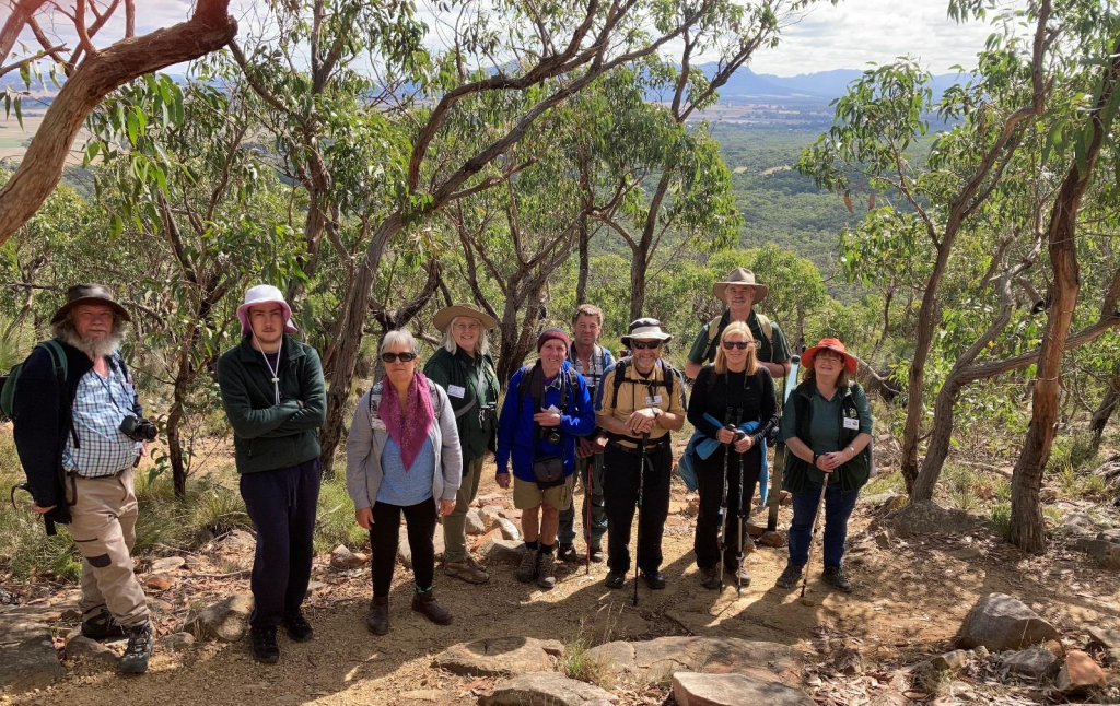
Southern Grampians day walk – The Piccaninny and the Dunkeld Arboretum.
Leaders: Ross Simpson and Fiona Robertson (Saturday) and Peter Hocking with Trevor and Jan Kennedy (Sunday)
The Grampians is a series of steep-sided ranges of hard, gently-dipping sandstone alternating with valleys cut in softer red-brown siltstone and mudstone. Some of the broader valleys are developed on granites that intrude the sandstones. Sheets of alluvial sand have washed out from the hills onto the surrounding plains. There are over 900 species of flowering plants in the Grampians, some of which are found nowhere else. Plant communities include sub-alpine herb-fields, tall forests, heath communities, fern gullies and marshes. Over 190 species of birds, 35 species of mammals, 28 species of reptiles and 11 species of frogs have been noted in the Grampians. The sandstone peaks of Mt Sturgeon and Mt Abrupt dominate the skyline at Dunkeld. There is a viewing-point on the Glenelg Hwy about 1.5 km southwest of Dunkeld, where the typical form of the peaks of the eastern Grampians, known as a cuesta, can be clearly seen. These cuestas have a steep escarpment on the eastern side while the western slopes follow the dipping beds of erosion-resistant sandstone. These slopes are known as dip slopes. The trees are mainly Brown Stringybark, Grampians Gum, Messmate Stringybark, Rough-barked Manna Gum, Scent-bark, Black Wattle, Oyster Bay Pine and Cherry Ballart. There are always wildflowers in bloom. The Piccaninny walk is located off the Grampians Rd between Mt Sturgeon and Mt Abrupt about 1.3 km from the intersection of Victoria Valley Rd and Grampians Rd. The gradient of the walking trail is not difficult for most walkers, and spectacular views of the surrounding landscape are seen along the way to the summit. A great diversity of wildflowers can be seen along the trail from the car park to the summit. The walk is also linked to the southern section of the new Peaks Trail.
Dunkeld Arboretum: Part of the southern section has been set aside to be managed for the native wildflowers, grasses and fauna. About 60 species of grasses and wildflowers have been identified including the nationally vulnerable Clover Glycine. The critically endangered Golden Sun Moth has also been seen here flying on warm sunny days in late November and December. Interpretative signage has been erected on the site.
Report by Fiona Robertson
Saturday 17 April 2021; No. of participants: 9 guests and2 leaders.
Suitability of excursion for the group: very suitable (of two possible walks in the Grampians National Park we chose the one with the better graded track).
The group walked to the summit of the Piccaninny,and after enjoying the view (with landmarks pointed out by Ross), returned by the same track.
Plants-In flower:
Correa reflexa(red)
Ixodiasp.
Desert Flame Heath,
Epacris impressa(pink, white),
Banksia marginata
Leucopogon sp.
Dilwinia glaberrina
Plants –Not in flower:
Callitris rhomboidei
Grevillia dimorpha
Isopogon sp.
Amyema pendula
Xanthorrhoea australis
Birds
White-eared Honeyeater
Yellow-faced Honeyeater
Eastern Yellow Robin
Forest Raven
White-throated Treecreeper
Grey-shrike Thrush
Grey Fantail
Weebill
Wedge-tailed Eagle x 3
Striated Pardalote
Grey Currawong,
Laughing Kookaburra
Eastern Spinebill
Other
Swamp Wallaby
Shingle-back Lizard
Common Brown Butterfly
Dunkeld Arboretum and Native Grassland Reserve: The group walked around the wetlands and looked at the native grassland reserve and the old redgums and the old sawmill.
Birds
Emu
Crimson Rosella
Purple Swamphen
Magpie Lark
White-plumed honeyeater
Long-billed Corella
Welcome Swallow
Pied Currawong
Red Wattlebird,
Australian Wood Duck
Australian Magpie
Laughing Kookaburra
Silvereye
Grey Fantail
Eurasian Coot
Yellow-rumped Thornbill
Superb Fairy-wren
Rufous Whistler
Eastern Rosella
New Holland Honeyeater
Walkers, Bradys and Green Swamps – Wetlands tour – ecology/biology/geologyA tour of wetlands restored by Nature Glenelg Trust (NGT) to enjoy the increased birdlife and improved ecology of these areas.
Leaders: Greg Kerr, Sarah Patterson (Saturday) and Mark Bachmann (Sunday)
Bradys Swamp is adjacent to North Boundary Rd on the southeast boundary of the Grampians/Gariwerd NP (235 ha is Crown land and 253 ha is private land).Public access is off Lynch’s Crossing Rd. The track from the gate at Lynch’s Crossing Rd is not trafficable in winter and spring. Bradys Swamp has the most reliable fresh water supply in southwest Victoria. It once acted as a sponge for floods issuing from the park, reducing the peak flooding downstream. With the consent of the owners of half the swamp, restorationof this wetland began in March 2014 when NGT, with the help of volunteers, sandbagged the outlet drain to a level that allowed the outflow to occur at the natural sill level. The huge drain channel was backfilled in 2015, to complete the task. There hasbeen too little rain in most years since 2015 to maintain water across the swamp in autumn but the period of wetting has been extended. There are 4 main pools, of which the deeper western pool retains water for the longest time.
Walkers Swamp: In the 1950s, swamps further to the northeast were drained through Walkers Swamp, part of which was Crown Land, and across Lynchs Crossing Rd by a channel into Gooseneck Swamp. Swamps across the road were once linked to Walkers Swamp before an extensive network ofdrains was put in. NGT has worked with the Glenelg Hopkins CMA, DELWP, Ararat Shire, HFNC and other organisations and volunteers to fund and implement a plan to restore this wetland system. Visitors to Walkers Swamp can park at the Bird Hide and view the swamp from the top of the tower.The observation tower was donated to NGT in 2018.
Access to this bird hide is free at all times. Those who would like to enter the grounds need to contact NGT, the organisation that owns and manages most of the land, to arrange access. After a trial sandbagging of the outlet drain in August 2014, hydrological studies and mapping followed.
The drain was sandbagged to a new level in March 2019 and the cutting was then filled in. A rock spillway was formed on the downstream lip of the sandbagged structure to deal with any flood.The works included raising the road adjacent to Walkers Swamp by about 50 cm and installing culverts to extend Walker Swamp into a 2 km chain of wetlands to the south, and levelling the old plantation mounds on the swamp.
Green Swamp: This 120-ha shallow freshwater marsh is surrounded by private land adjacent to Red Hill Rd. Access is either from the Glenelg Highway at Burnside Lane or from the Glenthompson–Ararat Rd. Public access to the wetland is restricted but many of the birds, including Brolga, may be seen from Red Hill Rd. NGT invites birdwatchers who wish to visit the site, and to share their observations, to contact them to arrange access.
Comment
Participants from Saturday’s excursion returned in great excitement having seen 168Brolga near Green Swamp. This sighting was not repeated on Sunday.All participants were very impressed with the work of Nature Glenelg Trust in restoring these wetlands such that thewetlandsnow hold water and are a great refuge for native birds and other organisms.
Leaders: Elizabeth Fenton and Glenys Cayley
Elizabeth has an extensive knowledge of the diverse flora at the Wannon Scenic Reserve –most of the time will be spent here. The reserve has about 200 species of largely ground flora, and autumn flowering plants and fungi may be apparent.
Views over theWannon Falls are very scenic – water or no water.
The Thomas Clarke viewing area overlooking the Wannon Falls provides a different vista and returning to Hamilton via the Nigretta Falls providesan interesting contrast to the Wannon Falls rock formation.
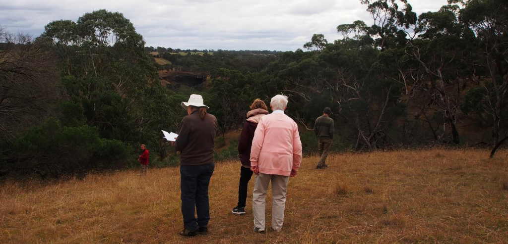
Wannon River–Stopping at various points of geological and riparian interest along the Wannon River –including the township of Cavendish, rapids on private farm property (Saturday)/Hewett Park (Sunday) and the scenic reserves at the Nigretta and Wannon Fallsand beginning with a quick view into the HFNC managed Kanawalla Railway Flora Reserve.
Leaders: Diane Luhrs andDaryl Delahoy (Saturday) and Diane Luhrs and Fiona Robertson (Sunday)
Kanawalla Railway Flora Reserve: Kanawalla is on an almost flat plain of an older basalt flow (>4 million years). Kanawalla is the only part of this railway line on the basalt remaining in a near-natural condition. This is a valuable remnant of volcanic plains grassland flora, of which less than 0.02% of its previous extent remains in the public domain. The reserve is 140 m wide by 750 m long on the Station Ground section and 30 m wide by 720 m long on the section south to MacFarlanes Rd.
The Settlers Walk along the Wannon River in Cavendishis lovely little walk. Plaques are placed along the trail representing the mid-1900s soldier settlers of the area. It is a quiet tranquil place.
Wannon Rapids near Delahoy’s farm: Daryl guidedus through his paddocks to a walk overlooking the rapids.
Hewett Park (a former 35-ha gravel quarry owned by the Southern Grampians Shire) of 410 Ma (Devonian) rhyolitic volcanic rock (i.e. not basalt), with Crown frontage to the Wannon River and a 197.5-ha triangle of the Streamside Reserve is located on the north side of theriver. Hewett Park can be entered at the top of the escarpment after crossing the Four Posts bridge.
Nigretta Falls and Wannon Falls lie within 10 km of each other on the Wannon River but they have quite different styles. The Nigretta Falls are a more interesting multi-channel cataract of smaller drops and bounces guided by patterns of joints in 410 Ma (Devonian) rhyolitic volcanic rock (i.e. not basalt). The water has enlarged the joints and plucked blocks out to form a series of complex cascades
The Wannon Falls are a classic ‘hard bed over soft’ style in which a young (Quaternary), hard basalt lava flow is undermined by erosion of the softer, weathered lava and sediment beneath it to form a spectacular vertical drop of 30 m into a deep plunge-pool.
Report by Diane Luhrs
The aim of this excursion was to show visitors one of the two main rivers of the region – the Wannon River (the other being the Glenelg River) – and to view the various landscapes and the forms of the river and associated flora and fauna along itscourse from the township of Cavendish to the Wannon Falls. The river rises on the eastern side of the Grampians and flows south before turning north-westwards at the southern base of the Grampians through the plains east of Cavendish. Along this northwest passage, the river variously forms many swampy areas, shallow wetlands and intermittent streams. It forms a river just east of Cavendish and flows through the township as a river before once again becoming a wide flood plain near the property of Kenilworth – polo was once a favourite sport on this flood plain. The river reforms as it passes through the rocky landscape of rhyolite. In this section rapids and steep sided banks are characteristic of the river. Further downstream the river becomes very deep before once again meeting rhyolite and forms a waterfall – the Nigretta Falls. Our final stop at the Wannon Falls shows a well-formed river plunging over a hard basalt bed and undercutting the softer weathered lava beneath. The Wannon River continues its wandering flow until flowing into the Glenelg River at Sandford, south of Casterton.
We also added two stops on our journey to Cavendish via Hensley Park Road. The first, the Kanawalla Railway Flora Reserve, is a reserve of HFNC interest. HFNC under the guidance of Rod Bird and with the support of Vic Track and the Glenelg Hopkins CMA, has been working on restoring the native vegetation of a section of this disused railway since 2005. In the 15 years since work began, 241 pines and cypress have been removed and invasive garden and farm weeds have been controlled and many hundreds of native plants (Silver Banksia, Sweet Bursaria and Drooping Sheoak) have been planted. Further to this, 86 species of native plants and 62 species of birds have been recorded in this time along this reserve.One of the participants who hadvisited the site over 10 years ago remarked on how much growth and improvement had occurred since that time. It is indeed a successful project and now can be enjoyed by locals and visitors alike.
Our second stop was to look at a large wetland constructed on the private property –Jigsaw Farms –to observe and record the birdlife there (see list below).
There was much to see and enjoy on this trip and I thank Deborah Evans (Saturday) and Jenny Rolland (Sunday) for compiling the sightings lists for our excursions
Saturday sightings (recorded by Deborah Evans):
1-Yuyana wetlands (Jigsaw Farms)
Pacific Black Duck 3
Blue-billed Duck 6
Musk Duck 2
Hoary-headed Grebe 3
Eurasian Coot 25+
Australasian Swamphen 3
Little Pied Cormorant 1
White-faced Heron 1
2-Settlers Walk, Cavendish
Pacific Black Duck 2
Grey Teal 1
Dusky Moorhen 1
Masked Lapwing 2
Little Pied Cormorant 2
Great Cormorant 4
Little Black Cormorant 3
White-necked Heron 1
White-faced Heron 1
Yellow-billed Spoonbill 1
Pied Currawong
Red-browed Finch
Great/Rain Moth cocoon
3-Wannon Rapids Flora Reserve and Daryl & Lyndal Delahoy’s property
Whistling Kite
Sulphur-crested Cockatoo (small flock as we came in
Crimson Rosella 5
Superb Fairywren
Red Wattlebird
New Holland Honeyeater
Australian Magpie (lots throughout the paddocks)
Pied Currawong
Grey Fantail
Magpie-lark
Little Raven
Eastern Long-necked Turtle
Rough Barked Manna Gum
River Red Gums in the paddocks
Wahlenbergia
Kangaroos (at least 60)
4-Nigretta Falls (lunch)
Wedge-tailed Eagle
Australian Magpie
5-Wannon Falls-Oval
Eastern Grey Kangaroo 8
Australian Magpie 9
Parson’s Band Orchid Eriochilus cucullatus; many on the oval, then even more in the surrounding bush.
Cranberry Heath (some flowers) Astroloma humifusum
Running Postman Kennedia prostrata
Grasstree ‘minor’ (triangular leaf) Xanthorrhoea minor
Fungi -Agaric sp
Common Brown Butterflies
Sunday sightings (recorded by Jenny Rolland)
1-Kanawalla RFR
Purple-crowned Lorikeet
Long-billed Corella
Grey Fantail
Grey Shrike-thrush
Sulphur-crested Cockatoo
White-winged Chough
2-Yuyana Wetlands (Jigsaw Farms)
Little Pied Cormorant
Masked Lapwing
Blue-billed Duck
Musk Duck
Pacific Black Duck
Eurasian Coot
Black Swan
Dusky Moorhen
Purple Swamphen
Hoary-headed Grebe
Whistling Kite
Welcome Swallow
Tree Martin
Superb Fairy-wren
White-plumed Honeyeater
Pied Currawong
Red-browed Finch
Great/Rain Moth cocoon
3-Wannon Rapids Flora Reserve and Daryl & Lyndal Delahoy’s property
Whistling Kite
Sulphur-crested Cockatoo (small flock as we came in)
Crimson Rosella 5
Superb Fairywren
Red Wattlebird
New Holland Honeyeater
Australian Magpie (lots throughout the paddocks
Pied Currawong
Grey Fantail
Magpie-lark
Little Raven
Eastern Long-necked Turtle
Rough Barked Manna Gum
River Red Gums in the paddocks
Wahlenbergia
Kangaroos (at least 60)
4-Nigretta Falls (lunch)
Wedge-tailed Eagle
Australian Magpie
5-Wannon Falls-Oval
Eastern Grey Kangaroo 8
Australian Magpie 9
Parson’s Band Orchid Eriochilus cucullatus; many on the oval, then even more in the surrounding bush.
Cranberry Heath (some flowers) Astroloma humifusum
Running Postman Kennedia prostrata
Grasstree ‘minor’ (triangular leaf) Xanthorrhoea minor
Fungi -Agaric sp.
Common Brown Butterflies
Sunday sightings (recorded by Jenny Rolland)
1-Kanawalla RFR
Purple-crowned Lorikeet
Long-billed Corella
Grey Fantail
Grey Shrike-thrush
Sulphur-crested Cockatoo
White-winged Chough
2-Yuyana Wetlands (Jigsaw Farms)
Little Pied Cormorant
Masked Lapwing
Blue-billed Duck
Musk Duck
Pacific Black Duck
Eurasian Coot
Black Swan
Dusky Moorhen
Purple Swamphen
Hoary-headed Grebe
Whistling Kite
Welcome Swallow
Tree Martin
Superb Fairy-wren
White-plumed Honeyeater
Little Raven
Australian Magpie
Grey Shrike-thrush
3-Cavendish Settlers Walk/Shelter/Shop
Darter
Little Black Cormorant
Little Pied Cormorant
Pacific Black Duck
White-faced Heron
Royal Spoonbill
Yellow-billed Spoonbill
White Ibis
Dusky Moorhen
Masked Lapwing
Whistling Kite
Corella sp.
Sulphur-crested Cockatoo
Galah
Crimson Rosella
Welcome Swallow
Grey Fantail
Grey Shrike-thrush
Pied Currawong
Australian Magpie
Common Blackbird
House Sparrow
Common Eastern Froglet
Common Brown Butterfly
4-Hewett Park
Wedge-tailed Eagle
Crimson Rosella
Laughing Kookaburra
Spotted Pardalote
Striated Pardalote
Yellow-faced Honeyeater
White-throated Treecreeper
Australian Magpie
Little Raven
Grey Fantail
Golden Whistler
Grey Shrike-thrush
Red-browed Finch
Parsons Bands Orchid
5-Nigretta Falls
Galah
Sulphur-crested Cockatoo
Laughing Kookaburra
Superb Fairy-wren
Yellow-faced Honeyeater
Australian Magpie
Little Raven
Common eastern Froglet
Brown Tree Frog
6-Wannon Falls Reserve
Sulphur-crested Cockatoo
Crimson Rosella
Laughing Kookaburra
Welcome Swallow
Brown Thornbill
Red Wattlebird
Australian Magpie
Grey Kangaroo
Parsons Band orchid
Cranberry Heath
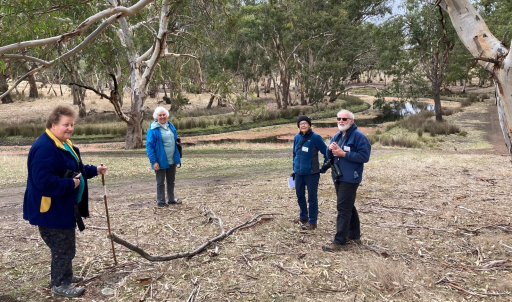
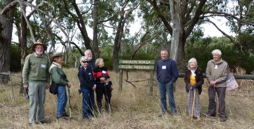
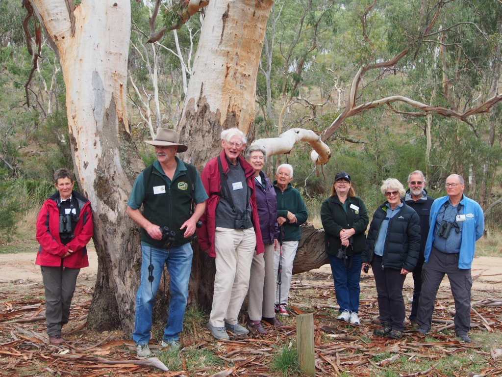
SEANA Autumn 2021 Get-Together at Hamilton – More Photos
ABN 23 918 778 150
Incorporation No A0044963D